Trail Highlights
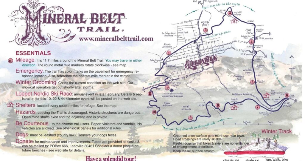
Mineral Belt Trail
The Mineral Belt Trail is a scenic and historic recreational trail that spans approximately 11.6 miles through the heart of Leadville. This high-altitude trail, situated at over 10,000 feet above sea level, offers breathtaking views of the surrounding mountains and showcases the area’s rich mining history with interpretive signs and displays along the route. Use the map to navigate your journey!
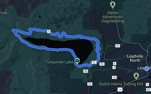
Turquoise Lake Road
The peaceful paved road around Turquoise Lake leads through pine forests and open areas looking out to high peaks in the Mosquito Range, Mt. Elbert and Mt. Massive, and the Upper Arkansas River Valley. Wind through its turns to access campgrounds and picnic areas, or ride around it by bike for a scenic workout. When the snow flies, it’s groomed for winter sports.
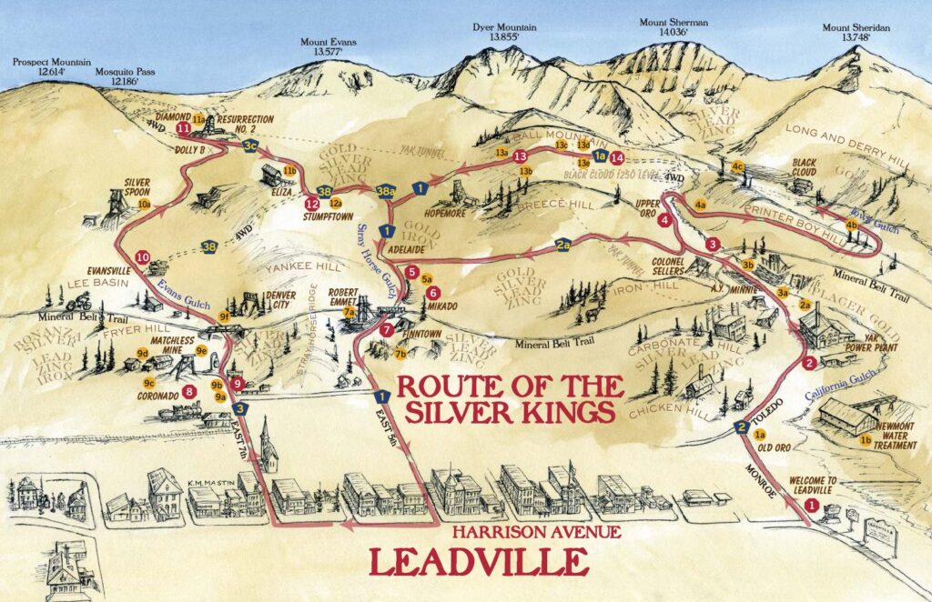
The Route of The Silver Kings
Tour through the 20-square-mile historic mining district surrounding Leadville. The self-guided tour is on dirt roads. The Route of the Silver King tour has 14 stops, including mines, power plants, ghost towns, and mining camps.